

.jpg)
.jpg)
.jpg)


.jpg)
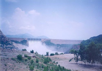
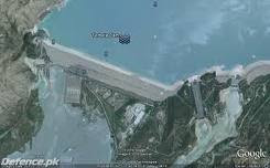
Tarbella Dam (Urdu: تربیلا بند) is a large dam on the
Description
The project is located at a narrow spot in the
A hydroelectric power plant on the right side of the main dam houses 14 generators fed with water from outlet tunnels 1, 2, and 3. There are four 175 MW generators on tunnel 1, six 175 MW generators on tunnel 2, and four 432 MW generators on tunnel 3, for a total generating capacity of 3,478 MW. Tambala Reservoir is 80.5 kilometres (50.0 mi) long, with a surface area of 250 square kilometres (97 sq mi). The reservoir holds 11,600,000 acre feet (1.43×10¹⁰ m3) of water, with a live storage of 9,700,000 acre feet (1.196×10¹⁰ m3). The catchment area upriver of the Tambala Dam is spread over 168,000 square kilometres (65,000 sq mi) of land largely supplemented by snow and glacier melt from the southern slopes of the
Main dam
The principal element of the project is an embankment 9,000 feet (2700 m) long with a maximum height of 465 feet (143 m). The total volume of earth and rock used for the project is approximately 200,000,000 cubic yards (150,000,000 m3) which makes it the largest man made structure in the world. The main embankment is a carefully designed, zoned structure composed of impervious core, bounded on both sides by gradually increasing sized material including coarser sands gravels cobbles and finally large sized riprap on the outer slopes. An impervious blanket, 42 feet (13 m) thick at the dam and tailing to 5 feet (1.5 m) at the upstream end, covers 5,700 feet (1700 m) of the alluvial foundation on the upstream side. These deposits in the valley are up to 700 feet (210 m) deep and in places consist of open work gravels. The dam crosses this essentially alluvial valley and connects the last points to high ground before the mountains give way to the plains. A 24 feet (7.3 m) thick filter drain mattress under the embankment together with nearly vertical chimney drain provides the necessary facility to collect the seepage.
Power station
According to the original plan, four (4) power units of 175 MW generating capacity each were to be installed on each of the tunnels 1, 2 and 3 located on the right bank with the ultimate installed capacity of 2,100 MW. Of these, four (4) units on tunnel 1 were commissioned in the year 1977. Due to increasing prices of the fossil fuel, the Govt of Pakistan has been laying greater emphasis on generation of cheap Hydro power. In pursuance of this policy, WAPDA carried out studies to tap the maximum power potential of Tambala. As a result, it has been found possible to install six (6) units, instead of four (4) only on tunnel NO.2. Units 5 to 8 on tunnel NO.2 were commissioned in 1982, and units 9 and 10 in 1985. Based on studies, four power units of 432 MW capacity each were installed on tunnel NO.3. Thus the total ultimate power potential of the project enhanced from 2100 MW as originally planned to 3478 MW. There are further plans to increase the power generation by 800 MW to bring the total Power Generation Capacity to more than 4200 MW.
Project implementation
On May 14, 1968, the World’s largest single contract for the construction of civil works at that time, the Tambala Dam Project was signed at a price of RS.2,965,493,217 ($ 623 Million) between the Water and Power Development Authority of Pakistan and the Tambala Dam Joint Venture which comprised a group of three Italian and three French heavy construction contractors. Later five German and two Swiss contractors also joined the group making up a consortium of thirteen European firms led by Italian firm namely Impregilo. The engineers for the design and supervision of construction and operation were from the firm Tippetts, Abbett, McCarthy and Stratton International Corporation (TAMS) of the
The construction of Tambala Dam was carried out in three stages to meet the diversion requirements of the river. In stage-I, the river Indus was allowed to flow in its natural channel while work was continued on right bank where a 1500 feet (457 m) long and 694 feet (212 m) wide diversion channel was excavated and a 105 feet (32 m) high buttress dam was constructed with its top elevation at 1, 187 feet (362 m) The diversion channel was capable of discharging 750,000 cu ft/s (21,000 m3/s). Construction under stage-I lasted 2½ years.
In stage-II, the main embankment dam and the upstream blanket were constructed across the main valley of the river
The reservoir created submerged much of Amb state.
Life Span
Because the source of the
Sedimentation, however, has been much lower than predicted, and it is now estimated that the useful lifespan of the dam will be 85 years, to about 2060.


Controversial Kalabagh dam (KBD) would bring more man-made disaster in Sindh. Non-availability of release of water as envisaged in "Water Accord - 1991" after signing the Accord 19 years is clear proof that Punjab wants to turn Sindh into desert.
ReplyDeletePresently, Indus delta - sixth largest in the world is on verge of unnatural sad demise in Sindh whereas 2.7 million people (Pakistani Muslim Sindhis) living in area between Kotri and Arabian Sea are dying from thirst and hunger but might-Punjab is not worried about this.